Is It Really Possible to Get Around Stratford Without a Car?

Challenging the Car-First Mindset
There's a persistent myth in our community—that you simply can't function in Stratford without owning a vehicle. It's repeated at dinner tables, in coffee shops along Ontario Street, and across local social media groups whenever someone asks about bus schedules or bike lanes. But here's the reality more of us are discovering: Stratford is actually more navigable without a car than most Ontario towns our size. It takes some planning, a willingness to rethink your routines, and knowledge of the options that actually work in our specific geography.
We've been conditioned to believe that small cities equal car dependency. Yet Stratford's compact footprint—roughly 10 kilometres from end to end—creates opportunities that sprawling suburbs simply can't match. Our grid-pattern downtown, established cycling infrastructure, and evolving transit system mean that many of us could reduce our car usage significantly without sacrificing quality of life. Some residents have already made the switch entirely.
This isn't about shaming anyone who drives. It's about presenting the practical alternatives that exist right here in Stratford for those who want to use them—whether you're trying to cut costs, reduce your environmental footprint, or simply don't want the hassle of maintaining a second vehicle.
What Public Transit Options Are Actually Available in Stratford?
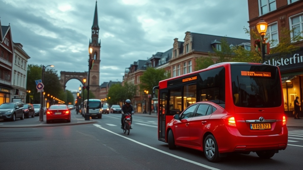
Let's start with the service that too many residents dismiss without ever trying it. Stratford Transit operates seven routes covering the entire city, with buses running every 30–40 minutes during peak hours. The system isn't perfect—most of us will admit the evening and Sunday schedules leave something to be desired—but for regular daytime trips, it's surprisingly functional.
Routes 1 through 7 connect all major neighbourhoods: from the northeast subdivisions near O'Loane Avenue, through the core along Ontario and Downie Streets, out to the west end factories and the industrial park. The fare is $3.25 per ride (cash exact fare) or $2.85 with a multi-ride pass. Monthly passes run $68 for adults—roughly what many of us spend on gas in a single week.
The real insight regular riders share? Plan your trip using the Transit Live Tracking system rather than relying solely on printed schedules. Buses in Stratford deal with the same traffic and weather we all do, and real-time tracking lets you leave your house when the bus is actually approaching—not ten minutes early on a freezing February morning.
Which Neighbourhoods Are Actually Walkable for Daily Errands?
Walkability in Stratford isn't distributed evenly—and that's worth understanding before you make any decisions about your transportation mix. The downtown core (roughly bounded by St. Patrick Street to the north, Waterloo Street to the east, Forman Avenue to the south, and Lorne Avenue to the west) offers the kind of genuine mixed-use density that's rare in Ontario cities our size.
Live within this rectangle and you can handle most daily needs on foot. The Downtown Stratford Business Improvement Area covers over 200 shops, services, and restaurants within a compact stroll. The Stratford Farmers' Market operates Saturday mornings at 40 Downie Street—easily accessible by foot for anyone in the core neighbourhoods. Your grocery options include the Sobeys on Ontario Street or independent grocers like The Local Community Food Centre when you want to stretch your legs.
The surrounding residential neighbourhoods vary. The east end (around Caledonia and East End streets) offers reasonable walking access to the YMCA, Festival Market Square, and several schools. The northwest area near Cambria Street has seen improvements in sidewalk connectivity, though the distances to major services remain longer. The farther subdivisions—particularly south of Forman Avenue or north of St. Vincent Street North—require more dedication to reach amenities on foot.
Where Can Cyclists Actually Ride Safely in Stratford?
Stratford's cycling infrastructure punches above its weight for a city of 32,000. The Stratford Perth Trail (also called the Millennium Trail or simply "the perimeter trail") creates a 9.5-kilometre car-free loop around the entire city—perfect for recreational riding, but also genuinely useful for commuters who plan their routes strategically.
The trail connects to the Grand Trunk Trail on the west side, providing a safe corridor to reach the industrial area and the factories along Trowbridge Street without sharing lanes with trucks. The connection to the Thames Valley Trail extends your range to St. Marys and beyond for the dedicated cyclist.
For on-street riding, the city has been gradually adding dedicated bike lanes. The Williams Street corridor now features separated lanes connecting the downtown to the east end. St. Patrick Street has shared lane markings through the core. It's not Amsterdam—but it's workable if you choose your routes carefully and accept that some streets (looking at you, Ontario Street during festival season) require caution or alternative paths.
The Stratford Active Transportation Committee publishes a cycling map showing the complete network, including quieter residential streets that function as de facto bike routes. Many experienced local cyclists use Front Street, Cambria Street, and St. Vincent Street North as east-west corridors rather than fighting traffic on the main arteries.
How Do Stratford Residents Combine Multiple Transportation Modes?
The secret to car-free living here isn't committing exclusively to one mode—it's learning to combine them strategically. This is where Stratford's small scale becomes an advantage rather than a limitation. The longest cross-town trip takes maybe 20 minutes by bicycle; by bus, you can cross the entire city in 25 minutes with a single transfer.
Consider the practical patterns that work: Taking the bus to the grocery store, loading your panniers, and cycling home with lighter loads. Walking to downtown appointments during the day, then catching the bus home when you're tired. Using the Stratford Transit taxi voucher program for those occasional trips that don't align with bus schedules (available for seniors and persons with disabilities).
Car-sharing through services like Vrtucar provides another piece of the puzzle—access to a vehicle for the monthly big-box run to Kitchener or the winter trip to visit family, without the daily costs of ownership. The Stratford location at the Stratford Public Library on St. Andrew Street makes pickup convenient for downtown residents.
What About Winter? Does This Actually Work Year-Round?
Let's address the elephant in the room. Yes, Stratford winters are real—there's no pretending otherwise when you're standing at a bus stop on a -20°C morning in January. The cycling season absolutely shrinks. Walking distances feel longer. This is when the car-free lifestyle requires the most commitment.
But it's not impossible. Winter bus ridership doesn't drop as dramatically as you'd expect—many of us who cycle from April through October switch to transit for the coldest months. The perimeter trail gets plowed, though often with a delay after major storms, making it usable for winter cycling if you're properly equipped (studded tires help enormously on the packed snow).
The downtown's compact nature becomes even more valuable in winter. That five-minute walk to the pharmacy in July is still a five-minute walk in February—just with more layers. Stratford's snow-clearing priorities focus on main sidewalks and bus stops, which keeps the core pedestrian-friendly even after significant snowfall. The city publishes winter maintenance schedules so you can plan routes that have been cleared.
What Should You Consider Before Giving Up Your Car?
We're not here to claim everyone in Stratford should sell their vehicle tomorrow. Your specific situation matters enormously. Do you work outside the city? Do you have young children with activities scattered across different neighbourhoods? Do you have mobility limitations that make walking or cycling difficult? These factors shape what's realistic for your household.
But even car-owning households can benefit from understanding these alternatives. The two-car family that becomes a one-car family saves thousands annually. The retiree who discovers they can handle most trips by bus frees up significant fixed income. The young professional who realizes they don't need that commuter vehicle can redirect those funds toward housing in our increasingly expensive market.
The infrastructure is here. The services exist. What's often missing is simply the knowledge of how to use them effectively in our specific context—not Toronto, not London, but Stratford with its particular street grid, its seasonal rhythms, and its community patterns.
Getting Started: Your First Week Without the Car
If you're curious about testing this lifestyle, start small. Pick one regular trip—your commute, your grocery run, your Saturday morning routine—and commit to doing it without your vehicle for a week. Download the Transit app for real-time bus tracking. Walk to an appointment you'd normally drive to, even if it takes fifteen minutes longer. Try the perimeter trail for a trip across town that doesn't involve Erie Street traffic.
Talk to the people you meet. The community of car-free and car-light residents in Stratford is larger than you'd think, and most of us are happy to share route advice, timing tips, and the practical knowledge that doesn't appear on official websites. Check the bulletin boards at the Stratford Community Centre on Lakeside Drive for local cycling groups or walking clubs.
The shift doesn't have to be dramatic. Each trip you complete without driving saves money, reduces congestion on our streets, and builds your confidence in the options that exist right here in our community. Stratford has spent decades building the infrastructure for a less car-dependent future—maybe it's time more of us started using it.